Virtual 3-D City Models in Temporal
Analysis of Urban Transformations
The information
contained in this web page is part of the scientific project
Spatial analyzes and modeling for a 3-D GIS. Grant project VEGA
1/0272/12. Ministry of Education of the Slovak Republic.
Authors: J. Kaňuk, J. Hofierka, M. Gallay
To be presented at GIS
Ostrava 2013
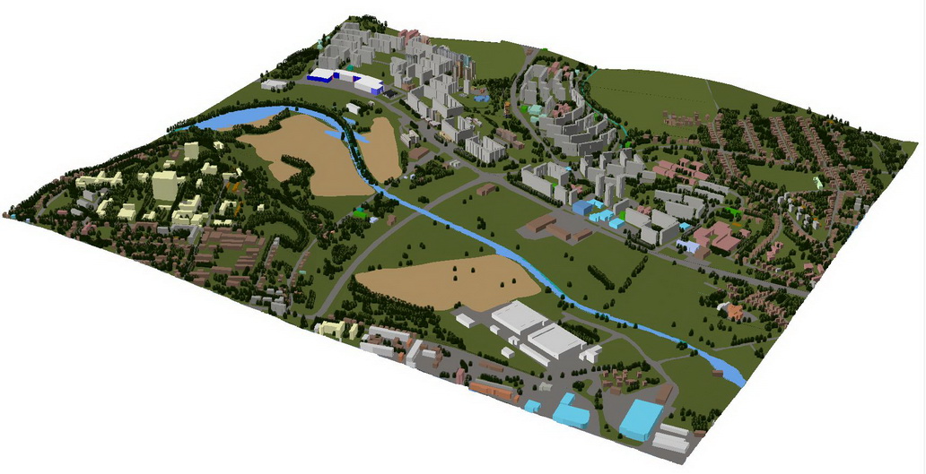
This sample area shows
part of the Presov city called Sekcov (see it on Google Maps
here http://goo.gl/maps/22W5S),
dominantly residential area with blocks of flats. This part of
the city underwent huge changes over the last 50 years. Virtual
3-D city models help to better understand the morphological and
also functional changes in the city.
(Later we will put some KML files here to use this data with
Google Earth/Google Maps).
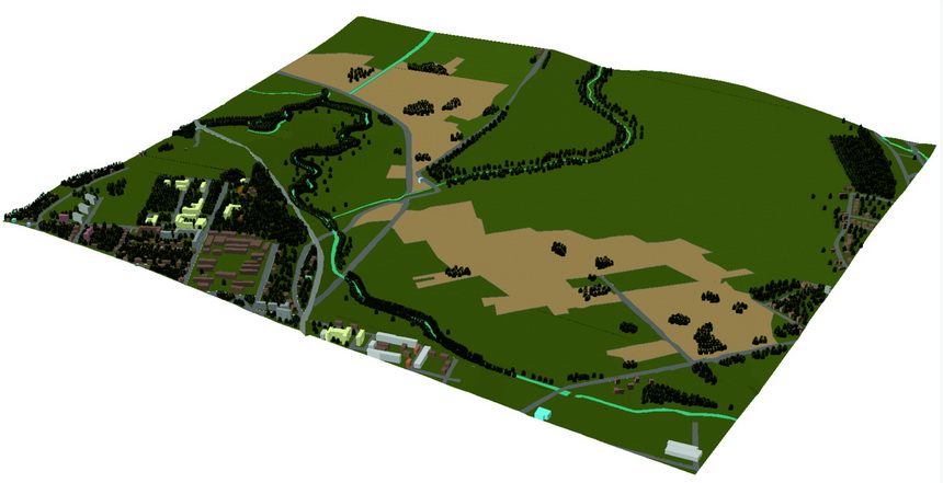
1959 - mostly swamped area
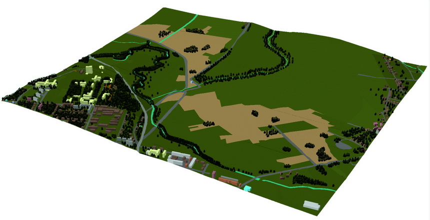
1969 - mostly swamped area with some construction activities
mostly outside Sekcov
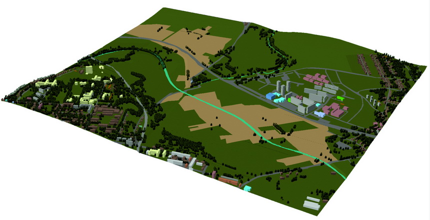
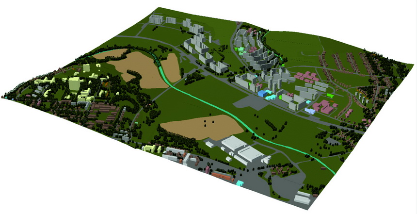
1979 - The Sekcov river relocated,
also changes in terrain and a start of new construction
(blocks of flats, schools and other facilities - shown in a
different color)
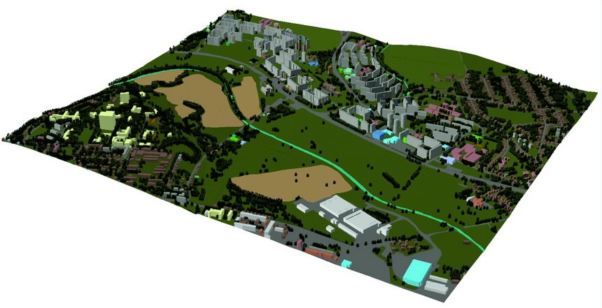
1989 - Changes in land use and
huge construction activities in the area
1989 - Changes in land use and
huge construction activities in the area
. 
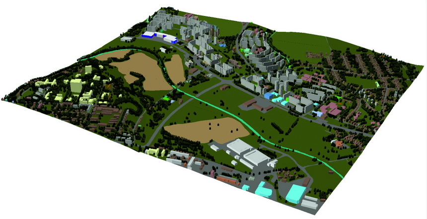
2012 - Rapid development of
commercial zones and large shopping centers. The area is
probably in the final stage of the development
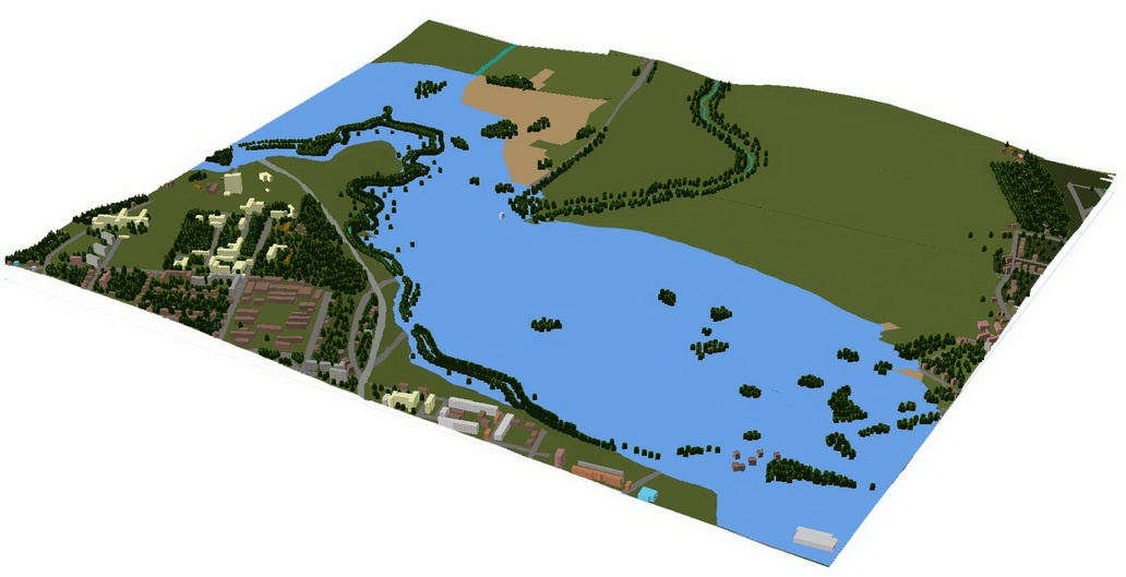
The Flood risk simulated for
1959
The Flood risk simulated
for 2012. The risk reduced due to relocation of the
river and terrain changes.
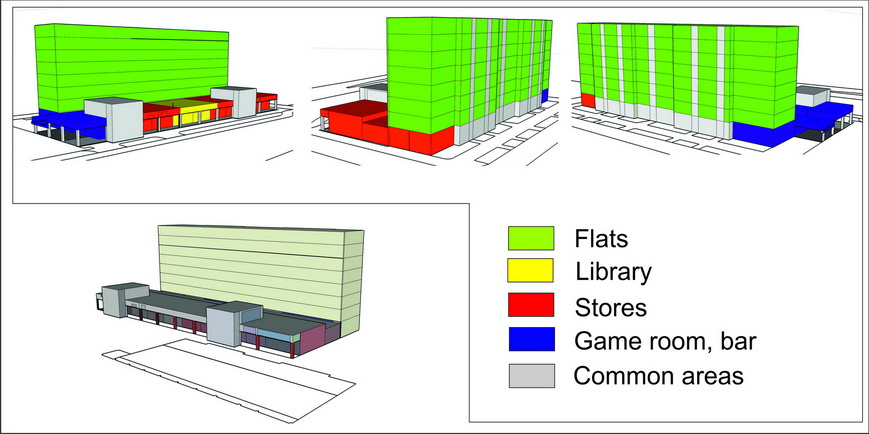
3D cadastre application. One building, many owners and various
uses of the building. Only a 3D GIS can be used effectively to
analyze this in a spatial context.