3-D city modeling for sustainable
energy applications
The information
contained in this web page is part of the scientific project No.
1/0355/09 supported by the
Ministry of Education of the Slovak Republic
("Modeling the distribution of solar radiation in urban areas and
its
potential for use").
Authors: J. Hofierka, J. Kaňuk
Selected publications:
Hofierka, J., Kaňuk, J.
(2010): Aplikácie 3D modelov
miest v
geografickom výskume. Zborník príspevkov 15. kongresu Slovenskej
geografickej spoločnosti v Košiciach. In press.
Hofierka, J., Kaňuk, J. (2009): Assessment of Photovoltaic
Potential in
Urban Areas Using Open-Source Solar Radiation Tools. Renewable
Energy
34, pp. 2206-2214.
Kaňuk, J., Hofierka, J., Rosič, M. (2009): Mapovanie areálov
bytových
domov v mestách Slovenskej republiky z aspektu energetického
využívania
slnečného žiarenia. Geografický časopis 61, pp. 139-151.
Hofierka, J., Kaňuk, J. (2009): Geographical approaches to the
assessment of solar resources in Slovakia (according to the
example of
a case study in the city of Prešov). In: Ira, V., Lacika, J.
(eds.):
Slovak geography at the beginning of the 21st century. Geographia
Slovaca 26, 2009, pp. 191-200.
New 3D
vector solar radiation model - v.sun (in cooperation with M.
Zlocha)
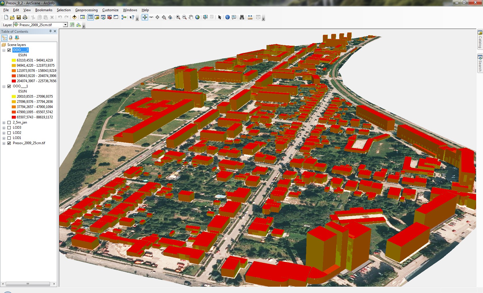
Solar radiation in January
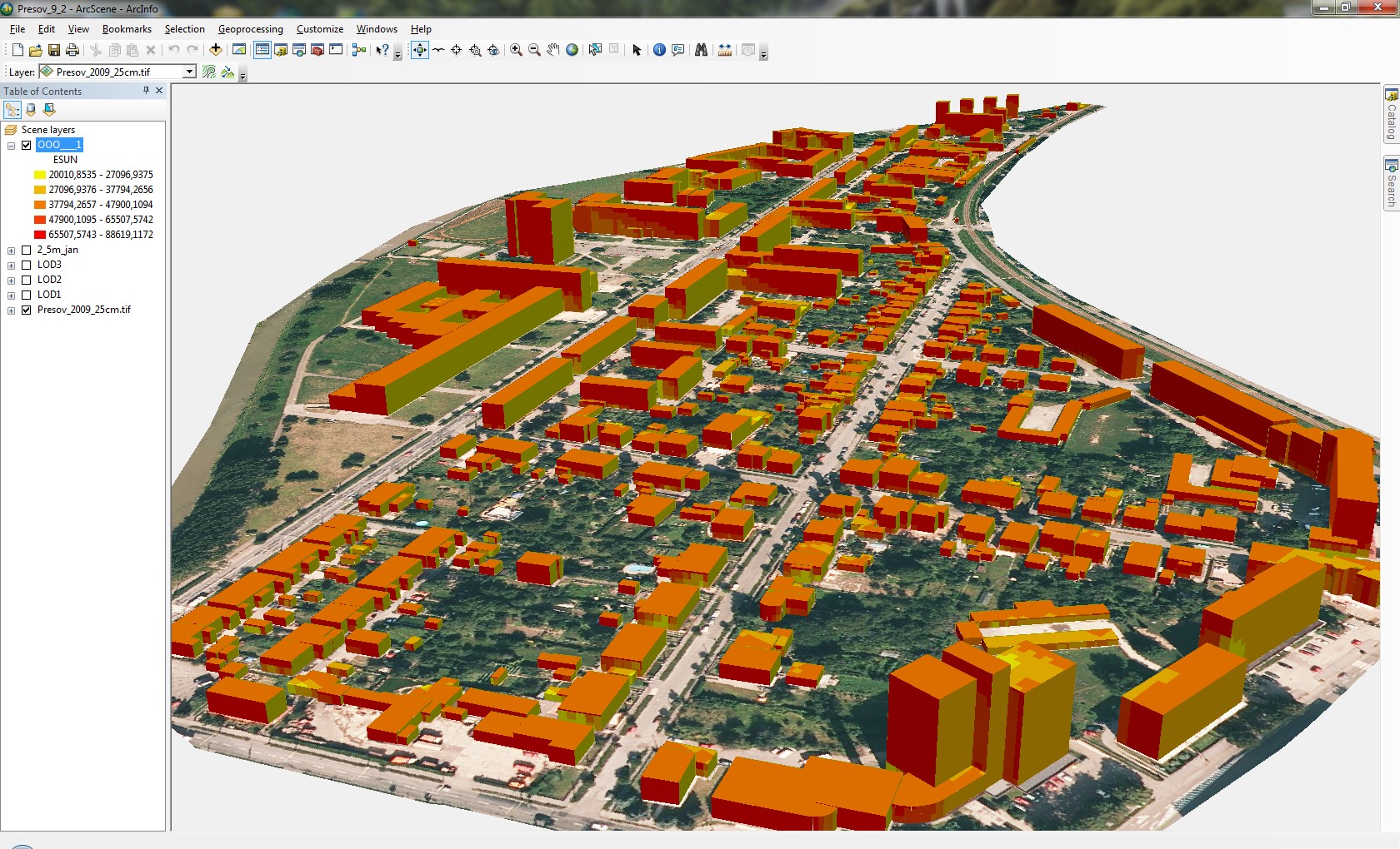
Solar radiation in July
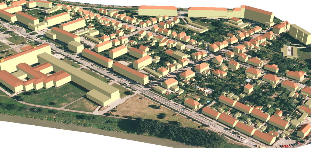
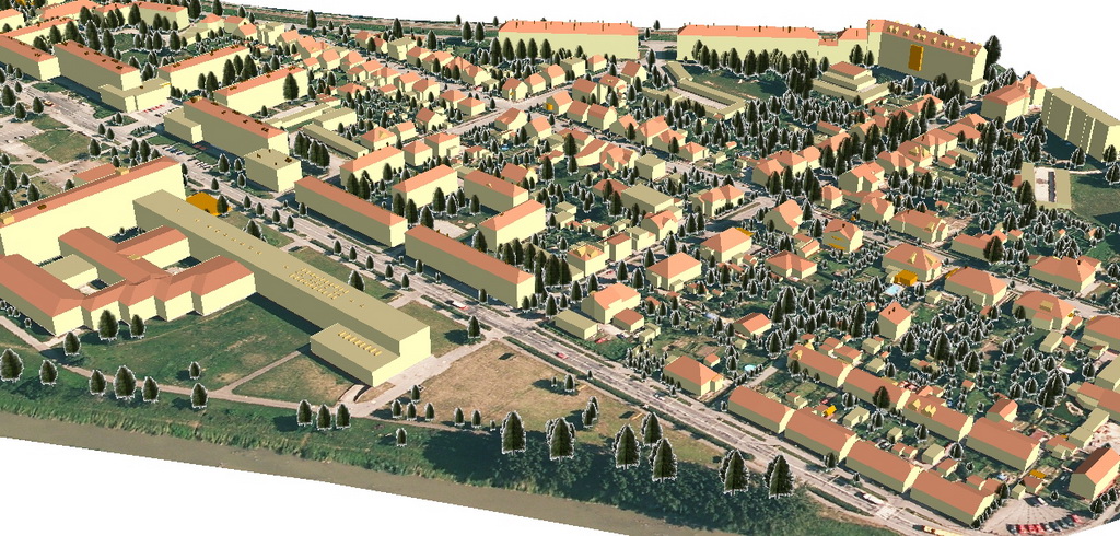
Geometry of 3D city models derived photogrammetrically
by
Eurosense, s.r.o.
Bratislava
LOD-1
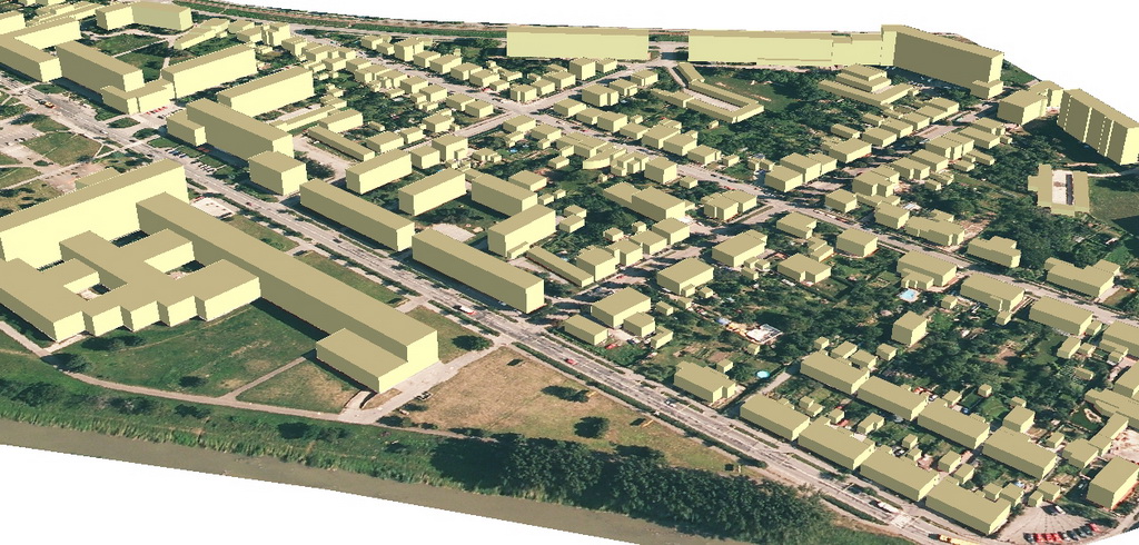
LOD-2
LOD-3
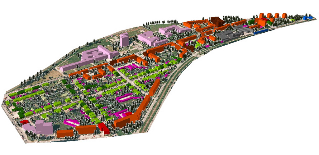
Applications
Demogeographic
analyses: Number of people living in the building older than 65
years
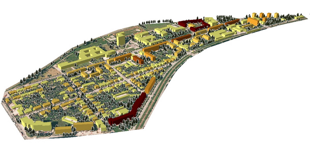
Functional
structure of buildings (residential houses, blocks of flats,
office
buildings, school b., ...)
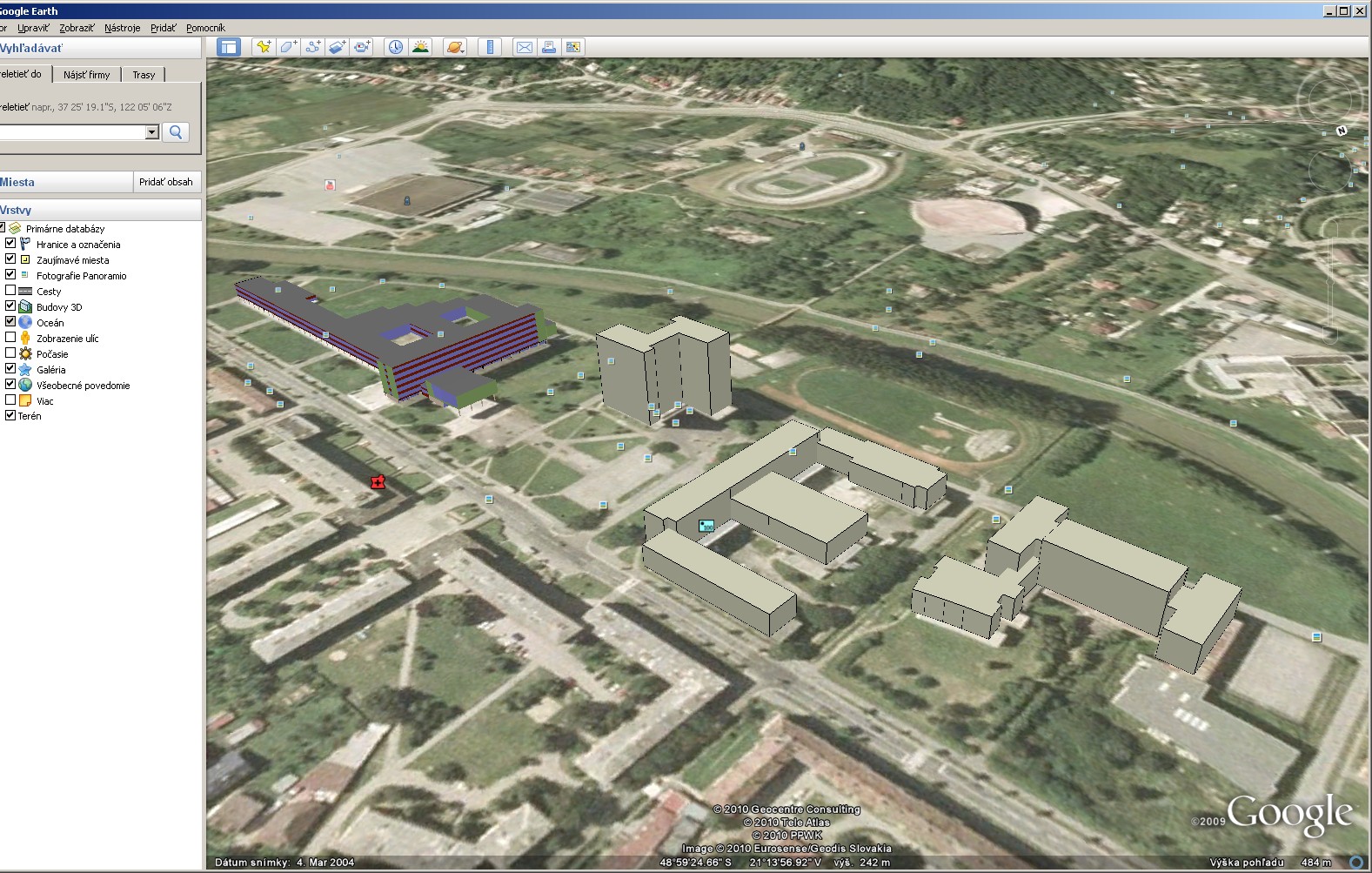
Google Earth
(the zip
file
includes
Collada file for a 3D model + .kmz file)
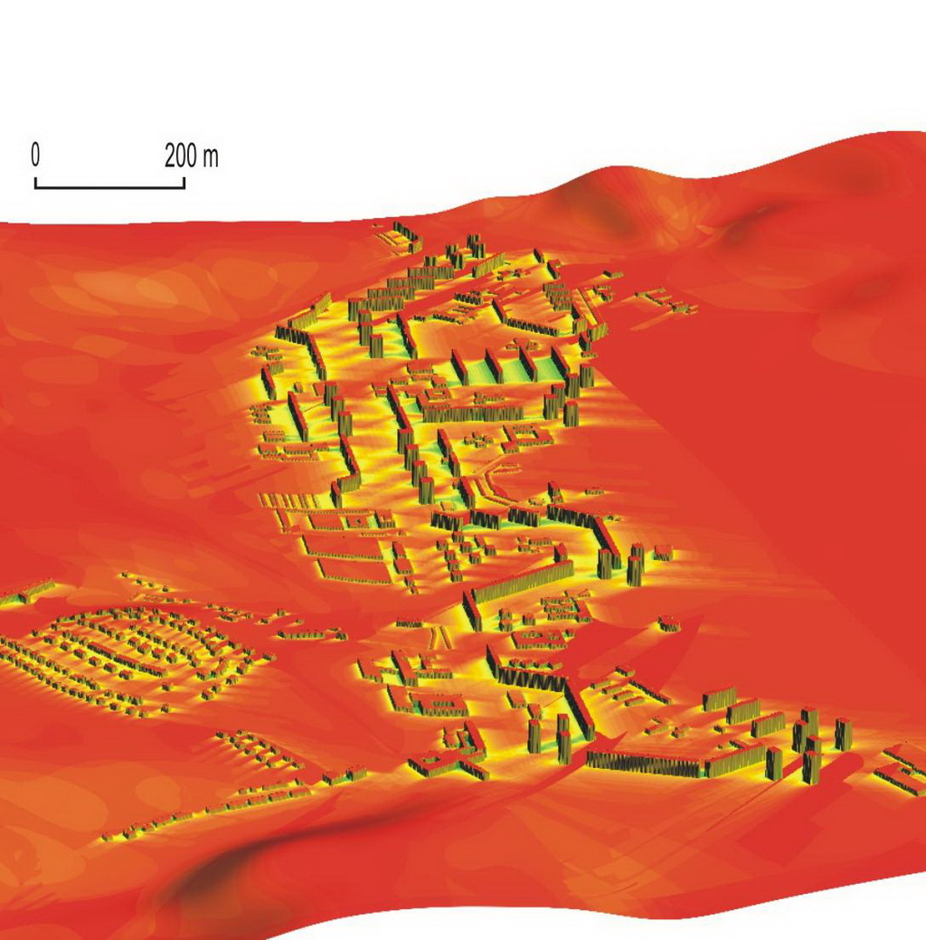
Energy balance
in
urban landscape of Presov, June 15 (modelled by r.sun of GRASS
GIS)